
Annual Report 2007
“There can be no purpose more inspiring than to begin the age of restoration, reweaving the wondrous diversity of life that still surrounds us.”
—E.O. Wilson
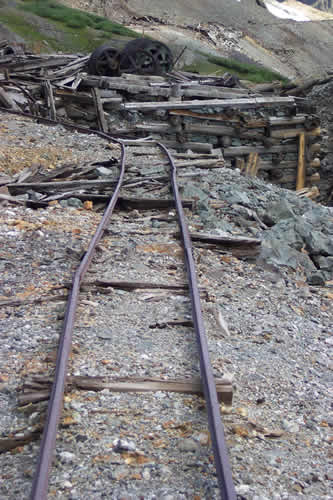
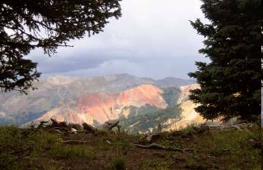
SILVER LAKE MILL IN SAN JUAN COUNTY
Introduction to TLR
The Trust for Land Restoration (TLR) — a non-profit land trust based in Ridgway and working statewide — is recognized as a leader in understanding and managing environmental liability so that lands degraded by mining and other human impacts can be restored and conserved. TLR primarily works in two ways:
- as a local land trust, focusing on easement and fee acquisition projects in Ouray, San Miguel, and San Juan Counties that other land trusts lack the expertise or time to undertake;
- as a statewide partner to citizen groups, local governments, and state and federal agencies seeking to cleanup and conserve abandoned mine sites in their communities.
TLR Leveraged Over $3.5M for Projects Since 2000
Since its inception in 2000, TLR has been responsible for winning more than $1 Million in grants and contracts for itself and its partners to characterize and cleanup abandoned mine sites, principally in Ouray, San Miguel, and Summit Counties. TLR’s partners have brought an additional $2.5 M to these projects. As a land trust, TLR now holds 12 conservation easements totaling 3215 acres of protected land in Ouray and San Miguel Counties. Among the easements TLR holds are San Miguel County Down Valley Park that facilitated funding of pond and river corridor restoration at the park using Idarado Resource Damage Fund money; four easements on Iron Springs Mesa northeast of Placerville that protect Gunnison sage grouse habitat; and an easement protecting the historic Yankee Girl Mine near Red Mountain Pass in Ouray County that allows for the restoration of one of the San Juan’s most iconic mine buildings, visible from US 550, which is the San Juan Skyway, Colorado’s only designated NationalScenic and Historic Byway.
TLR is one of the few land trusts in Colorado that understand and work with mining claims. Dispersed home and cabin development in the Rocky Mountains often impacts scenic open space and natural habitat values. Privately owned, patented mining claims are particularly problematic, because each claim, regardless of size, typically comes with the right to develop a homesite. Mining claims tend to be surrounded by public land, in many instances making them more desirable to develop, while at the same time making them more important to conserve. Complicating matters further for conservationists are a variety of well-meaning environmental laws that have the unintended consequence of scaring away would-be do-gooders because of fear of environmental liability.
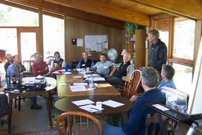
PAT WILLITS LEADS TLR BOARD DISCUSSION
2000-2008 TLR Accomplishments at a Glance:
$ 3.5m leveraged to conserve 3670 acres,
completed 300+ site assessments,
cleaned up 3 sites
_____________
- Twelve Conservation Easements totaling 3205 Acres;
- retiring 92 potential home sites;
- landing $800k CDOW cash to landowners;
- generating $90k in fees & $130k in endowment contributions to TLR.
- Helped bring 12 parcels totaling 485 acres into Public Ownership.
- Landed 7 grants & services contracts for TLR & partners totaling $1m
- Received $95k+ in private donations.
- Partnered to leverage $160k Summit County cash with $195k EPA grant to cleanup Shoe Basin Mine (Summit County).
- Secured USFS commitment of $600k for Carbonero Tailings Cleanup (Ophir Valley).
- Helped secure $200k GOCO funds & $250k Idarado Natural Resource Damage Funds to TLR partner projects.
Looking Back at 2007 Activities:
TLR Tackles Abandoned-Mine Land Impacts in the Ophir Valley
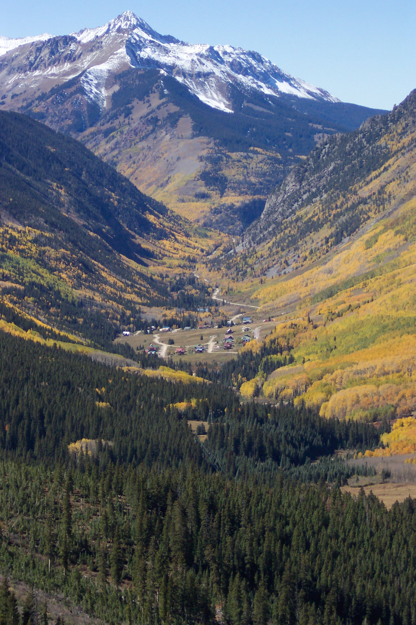
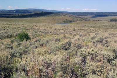
THE OPHIR VALLEY AS SEEN FROM OPHIR PASS
The Howard Fork of the San Miguel River, running through the Ophir Valley south of Telluride, has been a TLR priority since 2001. The Howard Fork had been the site of a productive mining boom that lasted from the late 1880s up to the early 1950s, leaving in its wake dozens of abandoned mining sites, several of which continue to degrad water quality to this day. The final report of a three-year study, the “San Miguel River Restoration Assessment”, identified the Howard Fork as the top restoration priority in the San Miguel River Watershed. In May of 2001 TLR convened and facilitated the “Howard Fork Roundtable”, bringing together landowners, local officials, state and federal regulators, and citizens to prioritize cleanup opportunities and identify information needs. All of TLR’s work in the Ophir Valley since 2001 has been to focus on furthering the implementation of the goals and objectives identified by the Howard Fork Roundtable.
In 2002, TLR landed an EPA 319 grant to begin a series of Howard Fork water quality studies and hydrological investigations. Shortly thereafter, TLR entered into a Participating Agreement to consult on specific USFS-owned sites; hire sub-contractors to perform environmental investigation; provide public outreach; and coordinate USFS activities with neighboring private landowners, other federal agencies, state government, San Miguel County, and the Town of Ophir. Thanks to USEPA and USFS support, TLR and our hired sub-contractors completed the “Howard Fork Acid Rock Drainage (ARD) Source Interception Study”; obtained extensive water quality sampling and analysis; and provided environmental assessment and consulting in support of the Town of Ophir’s acquisition of the Ferric Oxide Placer Claim.
In 2007, TLR completed risk assessments of eight USFS sites; and provided environmental consulting and public outreach in support of pending $600,000 reclamation of Carbonero Tailings by USFS that is scheduled to be completed in 2009.
Two Red Mountain Mining Claims Offered for Donation to Local Land Trust
Telluride Foundation Pledges $5,000 Trust for Land Restoration Seeks Additional $5,000 to Complete
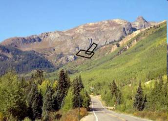
VIEW FROM US 550 OF CHICKEN AND NEW DEAL MINING CLAIMS.
RIDGWAY- The owners of two patented mining claims near Red Mountain Pass have offered to donate the land to the Trust for Land Restoration provided the local land trust can raise funds to cover short-term transaction and long-term stewardship costs. The claims are named the Chicken and the New Deal. They together total about 20 acres, and are located in Ouray County, on the north side of Red Mountain Pass, west of US 550, in Commodore Gulch.
“The names ‘Chicken’ and ‘New Deal’ hearken back to the Depression Era of the 1930’s, when these claims were originally staked,” said Pat Willits, TLR’s Executive Director. “I would think the names relate to Roosevelt’s New Deal program goal to put a ’chicken in every pot’ meaning the government was trying to help people survive the severe economic downturn.”
Now TLR is seeking to raise the necessary transaction and endowment costs to be able to accept the donation of the two properties. “Even though the claims are being offered to TLR as a donation, we will incur short-term costs and fees, plus become responsible for long-term obligations to monitor and take care of the property,” said Willits. “We estimate those costs to total $13,000, but thanks to the pledge of a donation of $5,000 to TLR from the Telluride Foundation, and an in-kind donation valued at $3,000 by the Colorado Department of Public Health and Environment, TLR is left with just $5,000 to raise. We are hoping people will consider contributing to our ‘New Projects Development Fund’ to help us complete this deal.”
“Please go to our website at www.restorationtrust.org and click on ‘New Project Alert’ for photos, maps and lots of interesting information about this project. We’ve even got a link to a PDF of the original 1946 patent deed. Plus a link to a secure on-line donation page,” said Willits.
VIEW FROM POTENTIAL BUILDING SITE ON CHICKEN MINING CLAIM.
CDOW Steps Up to Protect Sage Grouse Habitat on Iron Springs Mesa
Protected Habitat on Iron Springs Mesa Grows to 1240 Acres!
PRIME HABITAT FOR GUNNISON SAGE GROUSE NOW PROTECTED BY CONSERVATION EASEMENT
Once again, we are very happy to report that landowners Chris and Deann Baker have placed a conservation easement covering an additional 480 acres of their ranch on Iron Springs Mesa, in San Miguel County. This is now the fourth CE now on the ranch, bringing the total of protected Gunnison sage grouse habitat to 1240 acres. But this time there is a new twist. The Colorado Division of Wildlife (CDOW) contributed to the “purchase-of-development rights” deal, by paying the Baker’s cash equal to about half the appraised value of the conservation easement. CDOW funding came via its Colorado Species Conservation Partnership program, and also gives CDOW research, monitoring and enforcement rights on all of the 1240 acres now conserved.
The Trust for Land Restoration is pleased to be the catalyst for Gunnison sage grouse habitat conservation. A once prolific rangeland species whose numbers have dwindled to less than 3,000, biologists point to habitat fragmentation by human activity, including road building, fencing, housing development, lack of predator control, and livestock overgrazing as the culprits responsible for the birds decline. Easement-required restrictions on Baker Ranch limit the subject acreage to no residential development, limited road building and maintenance, fences that discourage raptor perches, and a livestock grazing management plan that keeps cattle off during spring breeding season, and pulls cattle by early fall to maintain winter feed for the grouse.
TLR is pleased to be one of a number of concerned partners working in southwest Colorado to protect Gunnison sage grouse. We especially would like to thank…
- The San Miguel Basin Gunnison Sage-Grouse Working Group
- San Miguel County Open Space and Trails Department
- The Nature Conservancy
- The Colorado Division of Wildlife
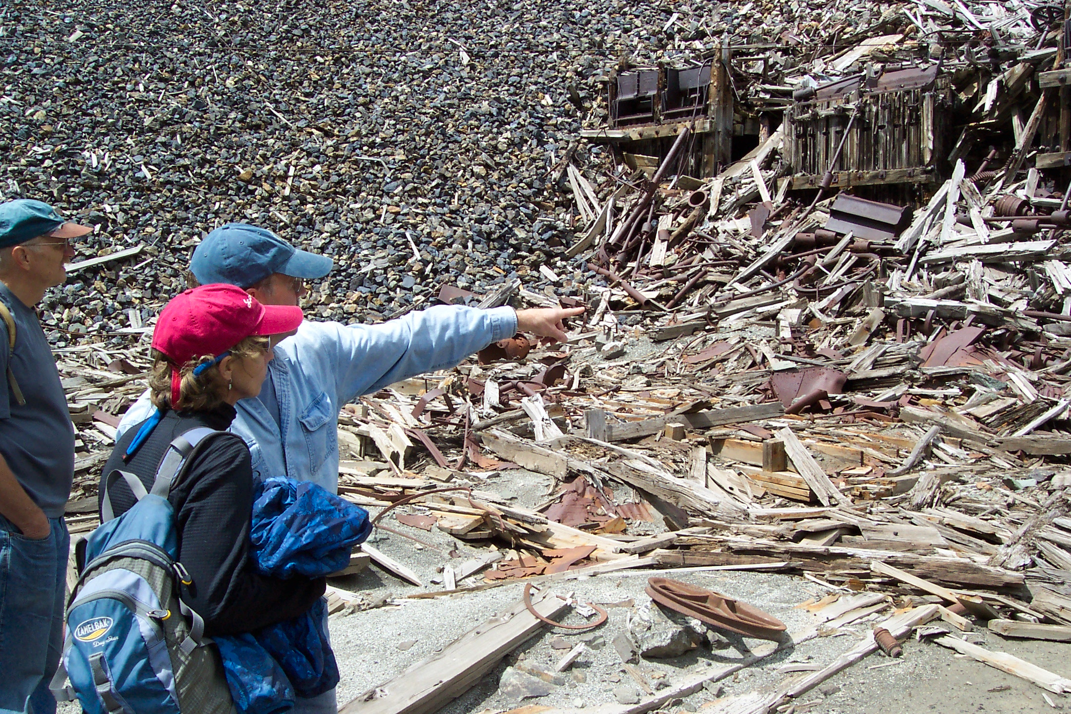
DAVID SCOTT (LEFT), DEB WILLITS AND GEOFF HOYL VIEW MILL RUINS NEAR SILVERTON
TLR CONSERVATION EASEMENT TALLY
With the 2007 donations of a new conservation easement on Iron Springs Mesa in San Miguel County, TLR now holds 12 conservation easements that altogether total 3205 acres. Combined, these easements protect important wildlife habitat, historic structures and scenic vistas enjoyed by the public. They reduce 92 potential residential development rights to 6.
With 2007 additions, the tally of all TLR conservation easements as of December 31, 2007 is:
| Easement name |
Year donated |
Location | Acreage | |
|---|---|---|---|---|
| Cimarron Ridge | 2001 | Cimarron Mtns. | Ouray County | 1,000 |
| Garard | 2002 | Ironton Park | Ouray County | 150 |
| Down Valley Park | 2003 | Placerville | San Miguel County | 5 |
| Fall Creek | 2003 | Wilson Mesa | San Miguel County | 470 |
| Baker Ranch I | 2003 | Iron Spgs Mesa | San Miguel County | 160 |
| Mystic Valley I | 2004 | Hastings Mesa | San Miguel County | 110 |
| Mystic Valley II | 2004 | Hastings Mesa | San Miguel County | 110 |
| Mystic Valley III | 2004 | Hastings Mesa | San Miguel County | 110 |
| Baker Ranch II | 2005 | Iron Spgs Mesa | San Miguel County | 120 |
| Yankee Girl Mine | 2006 | Red Mtn Mining District | Ouray County | 10 |
| Baker Ranch III | 2006 | Iron Spgs Mesa | San Miguel County | 480 |
| Baker Ranch IV | 2007 | Iron Spgs Mesa | San Miguel County | 480 |
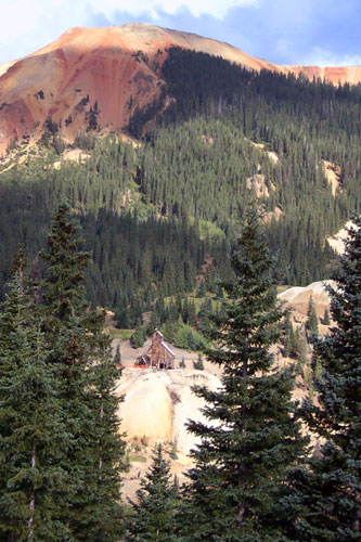
YANKEE GIRL MINE AS SEEN FROM US HIGHWAY 550 SCENIC OVERLOOK
The Trust for Land Restoration
2007 Income and Expense Statement
| TOTAL | ||||
| Ordinary Income/Expense | ||||
| Income | ||||
| Conservation Easement Fees | 39,004.00 | |||
| Contract Services Fees | 10,000.00 | |||
| Endowment Fund Donations | 28,000.00 | |||
| Unrestricted Donations | 29,600.00 | |||
| Total Income | 106,604.00 | |||
| Expense | ||||
| Bank Service Charges | 103.48 | |||
| Conferences & Training | 80.00 | |||
| Corporate Expense | 135.00 | |||
| Depreciation Expense | 208.75 | |||
| Dues and Subscriptions | 590.00 | |||
| Insurance | 1,037.00 | |||
| Licenses and Permits | 20.00 | |||
| Office Supplies | 417.20 | |||
| Payroll Expenses | 39,812.75 | |||
| Postage and Delivery | 93.26 | |||
| Printing and Reproduction | 91.41 | |||
| Professional Fees | 24,212.60 | |||
| Rent | 2,750.00 | |||
| Supplies | 39.43 | |||
| Telephones & Internet | 2,206.75 | |||
| Travel | 1,162.51 | |||
| Total Expense | 72,960.14 | |||
| Net Ordinary Income | 33,643.86 | |||
| Other Income/Expense | ||||
| Other Income | ||||
| Endowment Interest | 3,829.10 | |||
| Total Other Income | 3,829.10 | |||
| Net Other Income | 3,829.10 | |||
| Net Income | 37,472.96 | |||
| Dec 31, 07 | |||||
| ASSETS | |||||
| Current Assets as of Dec 31, 2007 | |||||
| Checking/Savings | |||||
| Operating Account | 29,477.93 | ||||
| Total Checking/Savings | 29,477.93 | ||||
| Other Current Assets | |||||
| TLR Endowment | 137,722.07 | ||||
| Total Other Current Assets | 137,722.07 | ||||
| Total Current Assets | 167,200.00 | ||||
| Fixed Assets | |||||
| Accumulated Depreciation | -1,779.30 | ||||
| Furniture & Fixtures | 455.46 | ||||
| Office Equipment | 1,982.04 | ||||
| Total Fixed Assets | 658.20 | ||||
| TOTAL ASSETS | 167,858.20 | ||||
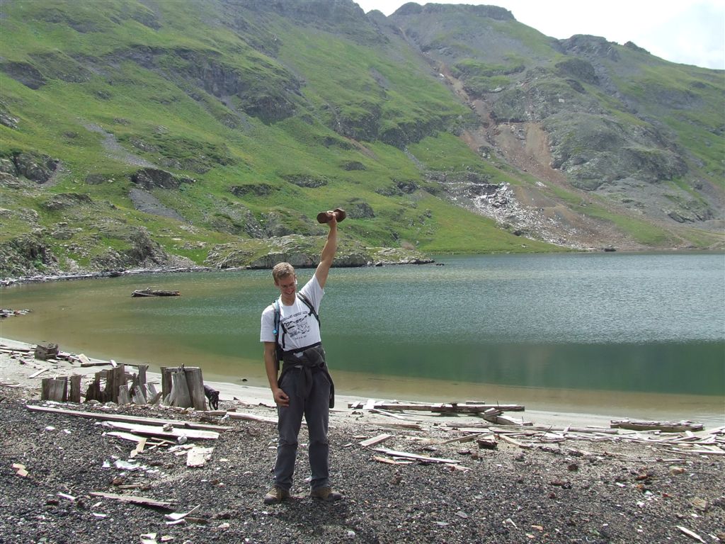
Doing the Heavy Lifting for TLR
 BIG THANKS TO TLR’s BIG 2007 DONORS
$10,000 and up
Chris & DeAnn Baker
Geoff & Christy Hoyl
$1,000 and up
Zach and Val Miller
Paul Phillips & Susan Zimmerman
David Scott
$100 and up
Brownell Bailey
Robert M. Clark
Jeff Kodish
April Montgomery
Pat & Deb Willits
2007 In –Kind
American Geological Services
Colorado Department of Public Health & Environment
Dave Folkes @ EnviroGroup
Jane Ellen Hamilton
Lofton Henderson
Zach Miller @ Davis Graham and Stubbs
Paul Phillips @ Holland and Hart
Bobbi Stewart @ WebDesign Farm
2007 Contracts
Ouray County
Tetra-Tech
United States Forest Service